Last Thursday we - Jo and I - went to Spurn for a day. I wanted to find out more about the movements of the tides at the tip of the peninsula.
First I felt confused whether we were really at the tip. Instead of the open sea - as I expected - there was a strip of land at the horizon. It's not easy to orientate yourself when there's water all around you.
A look at the OS map shows that Spurn points straight towards the opposite shore of the Humber - a fact I wasn't aware of previously...
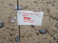
I marked the line where high tide left some debris at about 11:10 with a flag. Another flag marked the edge of the water when we arrived at 13:10.
I came back 4 hours later after a walk - almost at low tide. I measured in steps how much the water had receded from high to low tide. It must have been almost 60m. And according to the tide table the water level receded by about 4.4 meters in height.
The dark cloud in the image threw water at me horizontally when I walked back to Jo who was waiting for me in the car. I arrived there soaking wet - luckily only at my backside.
SCULPTURE AND INSTALLATION
a container for notions, thoughts and processes I encounter along the way
Monday, 30 June 2008
Wednesday, 11 June 2008
Present Spurn
The present peninsula started to form around 1600. In 1849 a storm breached Spurn (see strip12 on the map below) and "the peninsula became a string of islands" at high tide.
From the 1850’s onwards sea defences kept Spurn artificially in the same position. During the World wars it became a military stronghold - a reason to further upgrade the sea defences.
In 1961 the Ministry of Defence sold Spurn to the Yorkshire Wildlife Trust. The trust now runs the area as a nature reserve. The sea defences are left to deteriorate and the natural process can take over again. - Today erosion continues to eat into Spurn. At spring tide wash-overs of the neck occur from time to time.
(amended 21 July)
The map shows coastal changes around Spurn over the last 150 years. It combines 1st edition OS maps (1851/52) with recent aerial photographs (c Getmapping 2000).
Source: www.hull.ac.uk/erosion
I found this info in the following files:Source: www.hull.ac.uk/erosion
Development of Spurn Peninsula
The Holderness Coastline - The Management of Coastal Erosion
SPURN HEAD by V.J. May
update 2019: all the original links as above (in small print) are no more active, but please see:
https://www.urbanrim.org.uk/cache/Pye&Blott_Holderness_Erosion.pdf
Spurn cycles
Earlier on I mentioned that I’m looking into the phases of the moon and the rhythm of the tides at Spurn. Now I found out that not only the moon is waxing and waning but that Spurn is cyclic as well: "[Spurn] is a fluid feature, it is thought to undergo a life cycle of some 250 years, during which it gets destroyed, is reborn some metres further westward, stabilises, and then is destroyed again."
The story in more detail: Spurn is built by the sands and gravels eroded from the Holderness cliffs. These cliffs north of the peninsula recede about 2 meters per year. The eroded material is transported south by longshore drift. It forms a spit in lee with the coast line.
Later, when the north easterly waves eat further into the coast, Spurn itself becomes exposed and prone to erosion. It seems that the peninsula has been washed away in a cycle of about 250 years. It then reformed west of its former position to keep pace with the erosion of the cliffs.
Another more recent theory by the Institute of Estuarine and Coastal Studies suggests that only the link to the Holderness coast has changed. The tip of Spurn Point is anchored to glacial moraines dumped after the last ice age. So, it should be stable.*
Who knows? Probably Spurn will keep some of its secrets.
(amended 21 July)
*From: 'Sailing the Rails' by H. M. Frost
Subscribe to:
Posts (Atom)